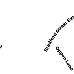
175-U202 BRADFORD ST EXT
Owner Information
HOWE DEREK A ET AL
11 BAY STATE RD #2
BOSTON, MA 02215


Property Details
175-U202 BRADFORD ST EXT is classified as a Residential Condominium (Condo).
The primary structure on this property was built in 2007. There are 1,720ft2 of built area within this property. There is 1,720ft2 of residential/living space within this property. This property is listed as having 4 rooms.
175-U202 BRADFORD ST EXT is valued at $1,140,300. The land is valued at $0 and the structures are valued at $1,140,300.
This property is in Zone R3. Confirm with local Zoning Board authorities to ensure there are no overlays or other easements on this property.
The most recent deed for 175-U202 BRADFORD ST EXT is recorded at the local registrar in Book 28046, Page 299. 175-U202 BRADFORD ST EXT was last sold on Monday, March 24, 2014 for $850,000.
Assessment data from fiscal year 2021.
Flood Data
According to the FEMA National Flood Hazard Layer, this property does not appear to be in a flood zone. It may also be in an area not yet reviewed. Nonetheless, confirm this information prior to taking any action.
To view the flood hazards around this property, create a FEMA "Firmette" Map of the area around 175-U202 BRADFORD ST EXT.
Broadband Internet Providers
| Provider | Type | Bandwidth (mbps) | |
|---|---|---|---|
| Comcast | Cable | 1000 | 35 |
| HughesNet | Satellite | 25 | 3 |
| GCI Communication Corp. | Satellite | 0 | 0 |
| VSAT Systems, LLC. | Satellite | 2 | 1 |
| Verizon New England Inc. | DSL | 15 | 1 |
| Viasat Inc | Satellite | 35 | 3 |
| T-Mobile | Fixed Wireless | 25 | 3 |
Broadband service provider data from December 2020.
Adjacent Properties
- 19 WEST VINE ST
Single Family Residential owned by VENABLES ROSS J ET UX - 25-UC2 TREMONT ST
Residential Condominium owned by DIANE SIDOROWICZ LIVING TR - 25-UB1 TREMONT ST
Residential Condominium owned by THE CANALES MCCAN FAM LIV TR - 25-UD1 TREMONT ST
Residential Condominium owned by ELAINE S REGIS ET AL LIV TR - 25-UD2 TREMONT ST
Residential Condominium owned by JEFFREY C GELPEY TR (50%) - 25-UE1 TREMONT ST
Residential Condominium owned by CAREY PAUL J - 25-UE2 TREMONT ST
Residential Condominium owned by BLACKWOOD REALTY LLC - 25-UF1 TREMONT ST
Residential Condominium owned by GOLD JUDITH H ET AL - 25-UF2 TREMONT ST
Residential Condominium owned by ROGER SECOURS TR ET AL - 25-UG1 TREMONT ST
Residential Condominium owned by GEORGE JOHN P ET AL - 25-UG2 TREMONT ST
Residential Condominium owned by ARENA GARY - 25-UA1 TREMONT ST
Residential Condominium owned by GILLACH MARY - 25-UA2 TREMONT ST
Residential Condominium owned by CHUNG-HSI WANG ANDREW ET VIR - 25-UC1 TREMONT ST
Residential Condominium owned by GUNN JAMES